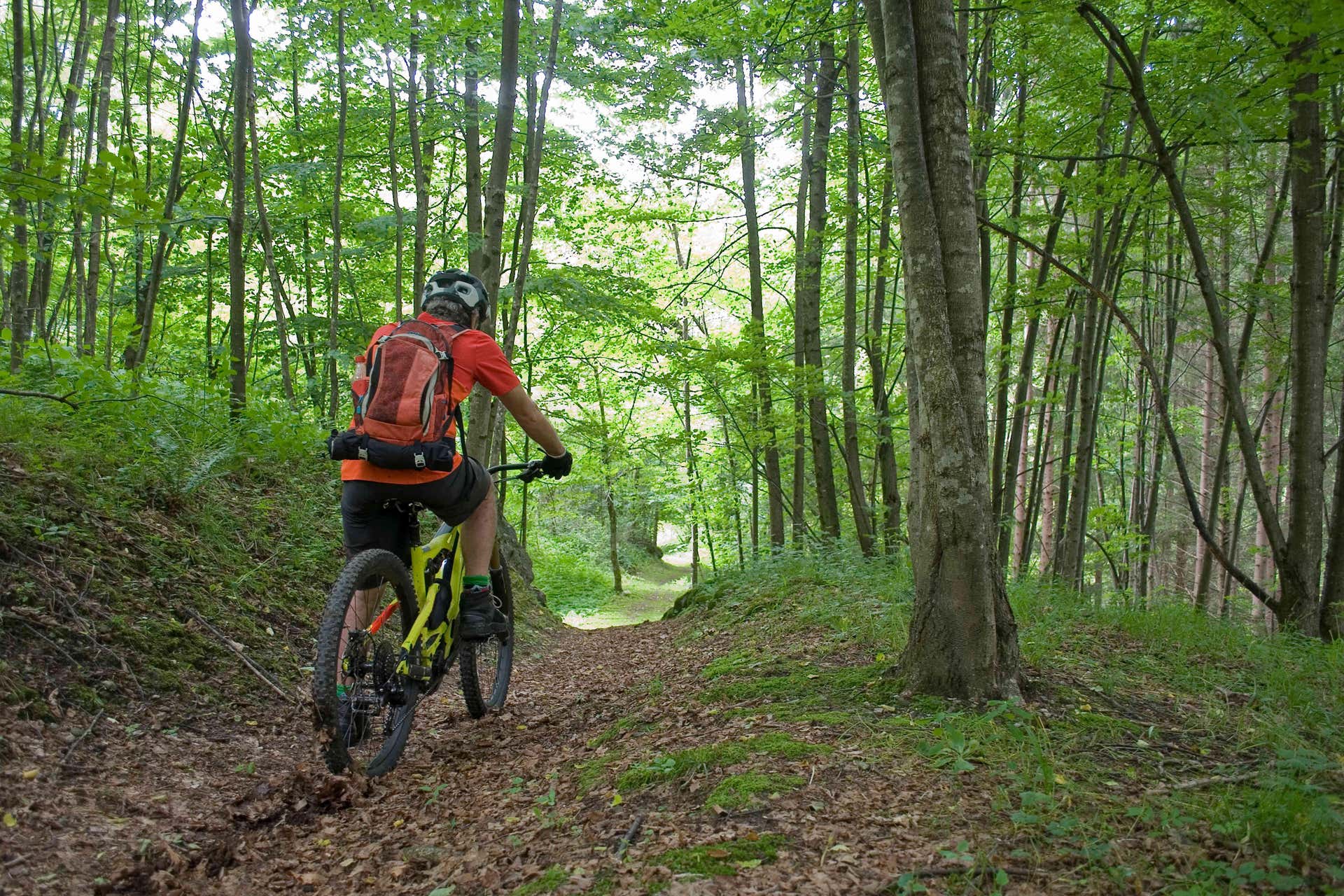
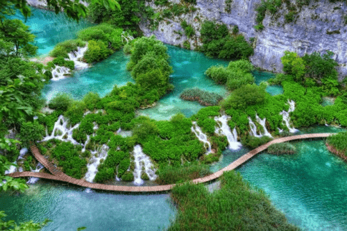
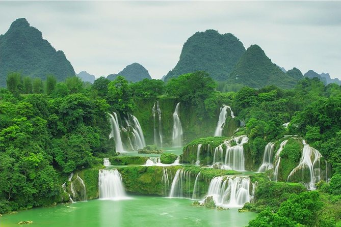
Are you planning to go hiking & trekking in Vietnam? Then this post is for you! A hiking trip should have beautiful contrasts, like steep green valleys or jagged limestone peaks, that make the trip more memorable. Vietnam’s geography has a wide range of challenges that are good for first-time hikers and hobbyists with more experience.
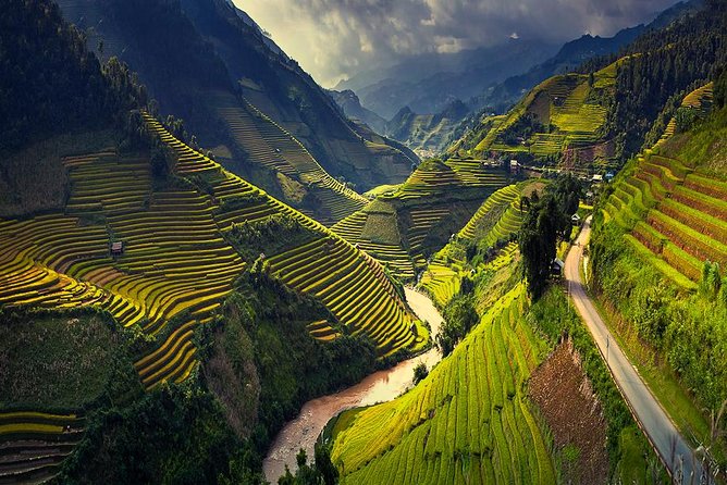
You’ll love this Southeast Asian country’s landscapes, and one of the best things is that each place has something different to offer. Vietnam has more than 3,000 kilometers of coastline, a history of more than 1,500 years, and hundreds of traditions. You’ll see rice fields, limestone mountains, ancient villages, pristine coastlines, and more.
If you go hiking & trekking in Vietnam, you will have an experience that you may always remember!
Read also:
- 20 Best Things to do in Hoi An, Vietnam
- Best Things to do in Sapa Vietnam
- 11 Best Things to do in Ninh Binh, Vietnam
- Best Attractions and Things To Do in Moc Chau, Vietnam
- 7 Best Things to do in Dalat, Vietnam
- Reasons to go Hiking & Trekking in Vietnam
- Lao Chai
- Cat Tien National Park
- Dinh Mountain
- En Cave, Phong Nha-Ke Bang National Park
- Mount Fansipan, Lao Cai
- Black Virgin Moutain, Tay Ninh
- Mai Chau, Hoa Binh
- Lang Biang peak, Da Lat
- Bidoup – Nui Ba National Park
- Ta Cu Mountain, Binh Thuan
- Ma Pi Leng Pass, Ha Giang
- Pu Luong Nature Reserve, Thanh Hoa province
- Bach Ma National Park, Hue province
- Ba Be National Park, Bac Kan province
- Cat Ba Island, Hai Phong province
- Yen Tu Mountain, Quang Ninh
- Chua Chan Mountain, Dong Nai
- Bu Gia Map National Park, Binh Phuoc
- What to Bring On Your Vietnam Hikes
- Best Time For Hiking In Vietnam

Reasons to go Hiking & Trekking in Vietnam
There are many beautiful hiking trails.
Vietnam has a lot of different landscapes, so it has a lot of great trekking routes that will satisfy any traveler’s need for adventure. There are different difficulty levels on the trails, so hikers of all skill levels can always find something they like. For one trekker, it could be a short walk through historical villages like Mai Chau or a long route in Cuc Phuong National Park. Some people might even like more challenging treks, like climbing Mount Fansipan, the highest point on the Indochinese Peninsula. These trails are excellent and let you see the best of Vietnam.
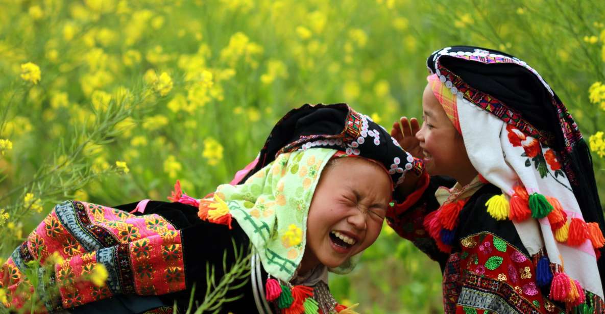
Meet people of different races.
About 85% of the country’s people are Kinh, and most live in big cities. Smaller ethnic groups tend to live in mountainous areas. Hiking & trekking is the best way to meet people from the site and get to know them better. They can be children playing or women working in the fields. It doesn’t matter who you talk to along the way; whether in a city or a rural area, this is a fantastic way to learn more about village life.
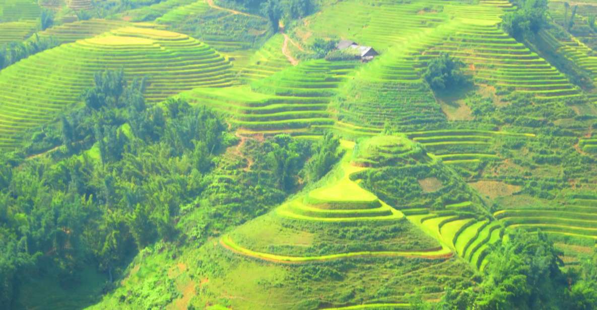
Beautiful views of the landscapes.
The hilly terrain that comprises three-quarters of Vietnam makes it considerably simpler to organize a hiking trip in the country. You can always find a place to go hiking and take in the breathtaking vistas from the summits of the peaks you climb, regardless of where you travel.
Immerse into Vietnamese culture.
Staying at a homestay is one of the best ways to hike in Vietnam. This lets you meet people who live near the mountains and make friends with them when you go hiking. You’ll also get to try real Vietnamese food, learn about farming, and learn about their culture. So, here are some of the best places to go hiking & trekking in Vietnam!
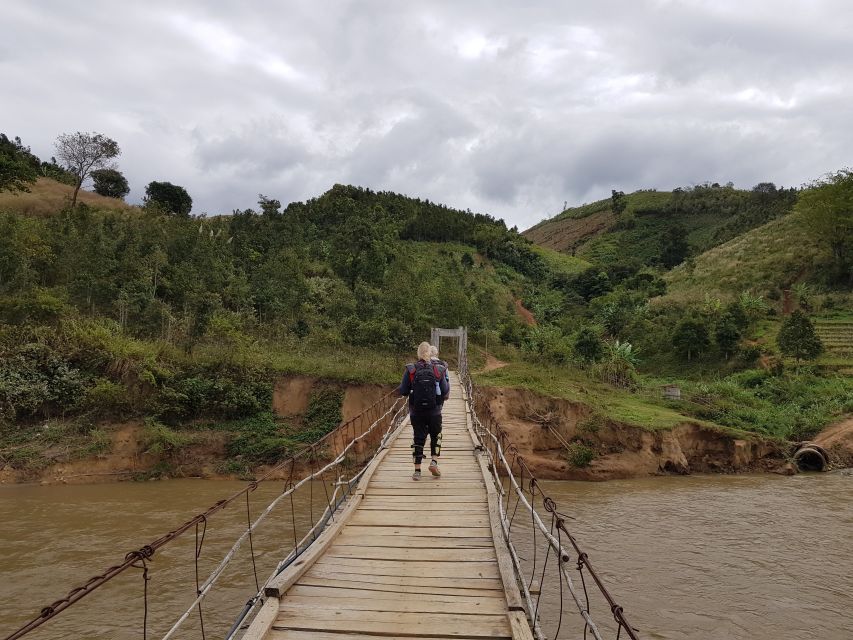
Lao Chai
- Vietnamese name: Lao Chải
- Location: Lao Cai province, Northern Vietnam
- Duration: 1 to 2 days
- Length: 9.6 to 11 kilometers
- Difficulty: Easy
Lao Chai
Sapa is known to be a beautiful green paradise in the north. Sapa trekking tours from Hanoi are very popular with people who want to learn more about the culture of Vietnam by hiking to remote villages in the hills for a few days. Even though Sapa is very popular, many routes and trails still make it feel like trekking in North Vietnam is still a secret. Depending on how long you want to spend hiking in Sapa, Vietnam, many different routes vary in length, difficulty, and distance.
Sapa is a beautiful place to hike in Vietnam. It is in Lao Cai Province. Many trekkers come to this area to see the golden rice terraces and the villages of the Hmong, Dao, Xa Pho, Tay, and Day, who are members of an ethnic minority. Since Sapa has a lot of hiking trails, Muong Hoa Valley’s Lao Chai and Ta Van Valley is a great destination for hiking & trekking in Vietnam for people who have never been hiking before.
The hike is mostly flat, but there are some hills to climb. The technical parts go through rice terraces and forest areas on a muddy, slippery path. Aside from that, most of the trail is on paved paths. From Sapa, you can spend one day traveling to Lao Chai and Ta Van or extend your trip to two days if you have more time. Explore Lao Chai on Google Maps
TourTeller’s Pick! – Top Sapa Tours

Cat Tien National Park
- Vietnamese name: Vườn quốc gia Cát Tiên
- Location: Dong Nai province, Southern Vietnam
- Distance: 2–26 km
- Duration: 1–3 days
- Difficulty: Easy
Cat Tien National Park
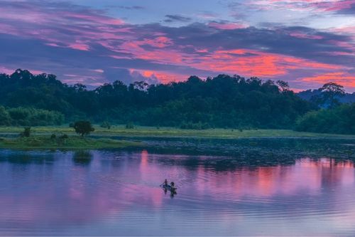
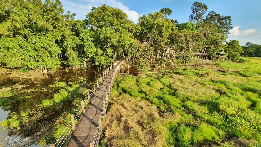
Cat Tien National Park is the biggest park in Vietnam. It is also the one closest to Saigon because it is in the province of Dong Nai. Hikers will enjoy exploring this park to see the vast Tung Trees and Uncle Dong redwood trees. There is also a lot of wildlife, like wild boar, sambar deer, gibbons, elephants, and, if you’re lucky, even a tiger now and then.
This is the kind of hiking & trekking where you might not need a tour guide. The paths for walking in the park are well-made, flat, and tricky. You can even relax in a hammock in the park and watch the rivers and jungle around you.
Cat Tien National Park comprises 72,000 hectares (177,916 acres) of tropical lowland rainforest full of different plants and animals. Elephants and leopards live in the jungle, but you’re more likely to see primates like gibbons, pygmy lorises, langurs, reptiles, amphibians, and many types of birds.
There are lodges in the vicinity that can assist you in finding guides. The most well-liked excursion is the journey through the park, which takes a half day and begins at the park headquarters in search of golden-cheeked gibbons. On the other hand, it would be to your advantage to get up before dawn to hear the gibbons hooting. The Dao Tien Endangered Primate Species Centre is where most trekkers go to observe further monkeys. The entrance fees contribute to financing the park’s conservation efforts for the monkeys. Explore Cat Tien National Park on Google Maps
TourTeller’s Pick! – Cat Tien National Park Tours

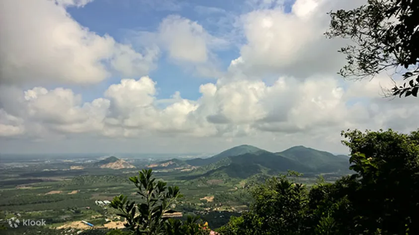
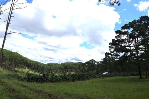
Dinh Mountain
- Vietnamese name: Núi Dinh
- Location: Vung Tau province, Southern Vietnam
- Distance: 4-8+ miles (6.4-12.8 kilometers)
- Duration: 3-5+ hours
- Difficulty: Moderate
Source: vnexpress.net
Dinh Mountain is a popular day hiking & trekking spot from Ho Chi Minh City and is close to the beach town of Vung Tau. Many trail runners and hikers go around the mountain to reach the top, which is 460 meters above sea level (1,500 feet high). The top of the hill doesn’t have a sign, but it’s on a big rock where you can see an expansive view of the Vung Tau area.
It’s easy to go hiking & trekking on this mountain, but there are some hills to climb. You can go up the mountain slowly because the trail is in the shade. Hikers can either go around the mountain in a circle or go to the top and come back. The path could have better signs, but there are red, yellow, and blue markers to help you find your way. If you don’t know the way, it’s best to bring a friend who does. As you walk, you’ll see a few temples and people living in the area. At the top, you’ll see a 360-degree view that will take your breath away. Explore Dinh Mountain on Google Maps
Day Tour Trekking to Nui Dinh from Ho Chi Minh City
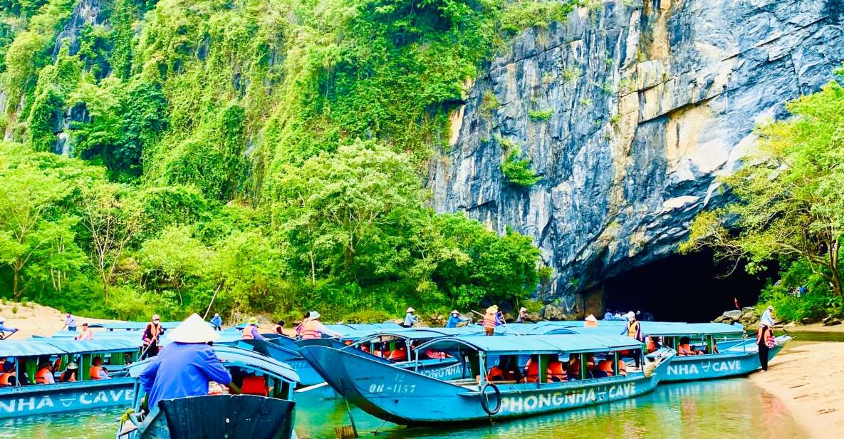
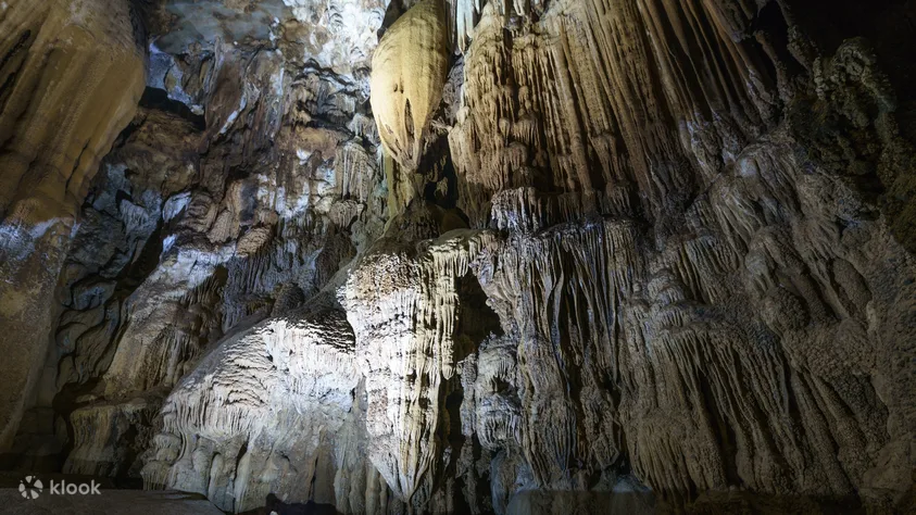
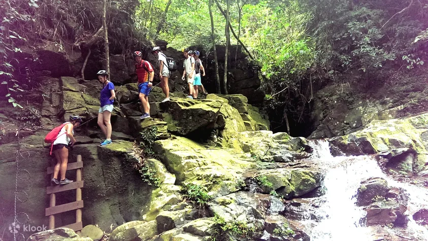
En Cave, Phong Nha-Ke Bang National Park
- Vietnamese name: Hang Én
- Location: Phong Nha-Ke Bang National Park, Quang Nam province, Central Vietnam
- Distance: 5.5-6.5 miles (3.4-6.5 kilometers) per day + caving on the second day
- Duration: 2 Days
- Difficulty: Easy-Moderate
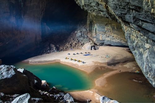
En Cave
Phong Nha is known as the “Adventure Capital of the World,” and there are a lot of caves to explore there. The Hang En Cave (Hang Én) in the Phong Nha – Ke Bang National Park is one of the best caves to visit. It is known for being the third-largest cave in the world. Its big sister, Son Doong, which is only 1.2 miles (2 km) away, is the world’s largest cave.
The out-and-back hiking trail is ideal for folks who have never gone trekking before because it allows hikers to take as much time as they need to complete the trail. The hike includes several rests stops along the way. When you reach the cave off the beaten road, you will better understand how significant this cave is. The length of this cave will be revealed to you on the second day of your exploration of the cave system. One of the fascinating hiking and trekking paths in Vietnam is the one that leads to Hang En Cave. Explore En Cave on Google Maps
Phong Nha-Ke Bang National Park Tours

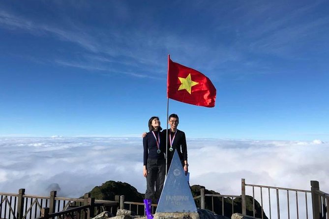
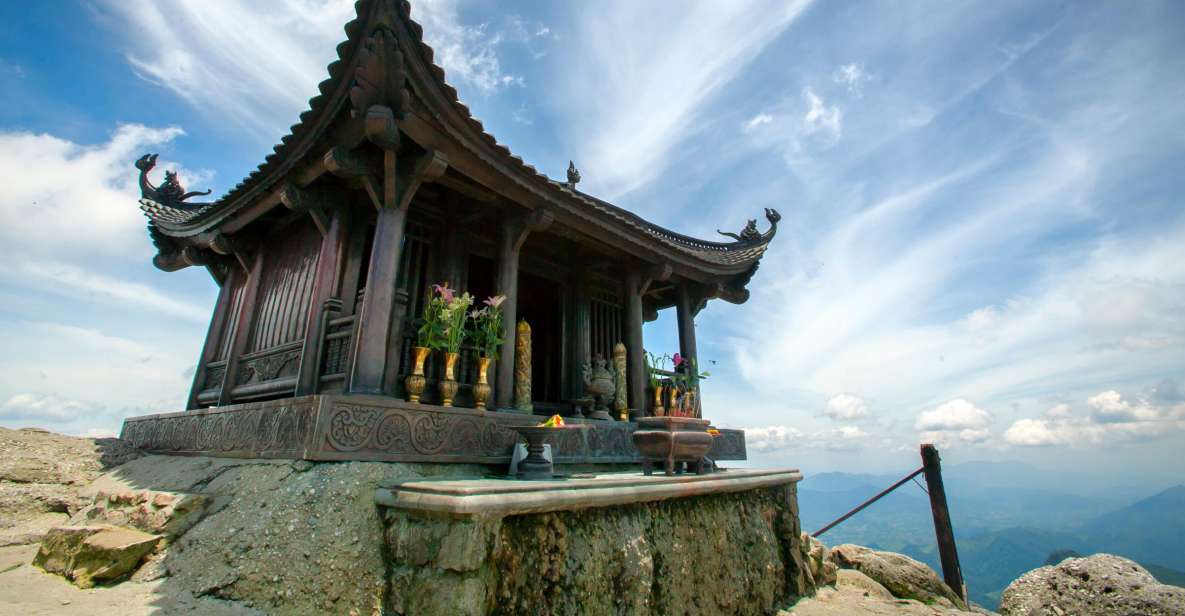
Mount Fansipan, Lao Cai
- Vietnamese name: Đỉnh Phan Xi Păng
- Location: Lao Cai province, Northern Vietnam
- Distance: 22.5 kilometers
- Duration: 2 to 3 days
- Difficulty: Intermediate to Hard
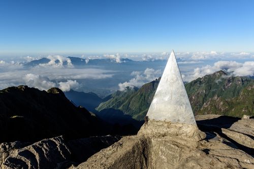
Mountain Fansipan
Mount Fansipan, which is 3,142 meters high, is the highest point in Vietnam. It is often called the “Roof of Indochina” because it is the highest point between Vietnam, Laos, and Cambodia. This hike is one of the hardest you can take in Vietnam. Before starting the hike, you can sign up at the ranger’s station and take the Tram Tom route, which most hikers do.
You’ll see forest areas with trees, running streams, and even wildflowers, but the trail also has giant boulders and stairs you’ll have to climb over. This hike is not easy; it is more of an intermediate level. You can see Buddha statues, temples, and the branded Sun World’s Fansipan Legend when you get to the top. At this must-see spot, you can take pictures with signs that show how high you had to climb to get there.
Even experienced hikers will find it hard to finish this hike in one day. It can take anywhere from six to twelve or more hours, depending on how experienced you are and how many breaks you take.
The “roof of Indochina” mountain can be reached most easily from Sapa by taking a local bus to the Tram Ton pass on the mountain’s northern side. From Cat Cat and Sin Chai villages, more challenging trails require camping for one or two nights.
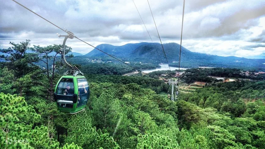
Guides are required, which is innovative in this rough terrain, but some people sneak up the trails without anyone with them. Trekkers in good shape can make the Tram Ton trail in a day and then take the cable car back across the Muong Hoa Valley. Most people take two or three days to get to the top, camping at remote spots. Why rush the trip when the scenery is so beautiful? Explore Mount Fansipan on Google Maps
Mount Fansipan Trekking Activities


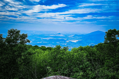
Black Virgin Moutain, Tay Ninh
- Vietnamese name: Núi Bà Đen
- Location: Tay Ninh province, Southern Vietnam
- Distance: 8 kilometers
- Duration: 6 hours
- Difficulty: Intermediate
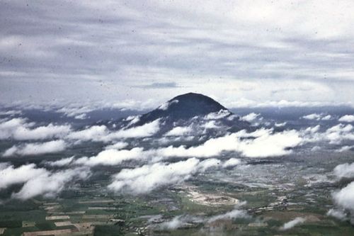
Black Virgin Moutain
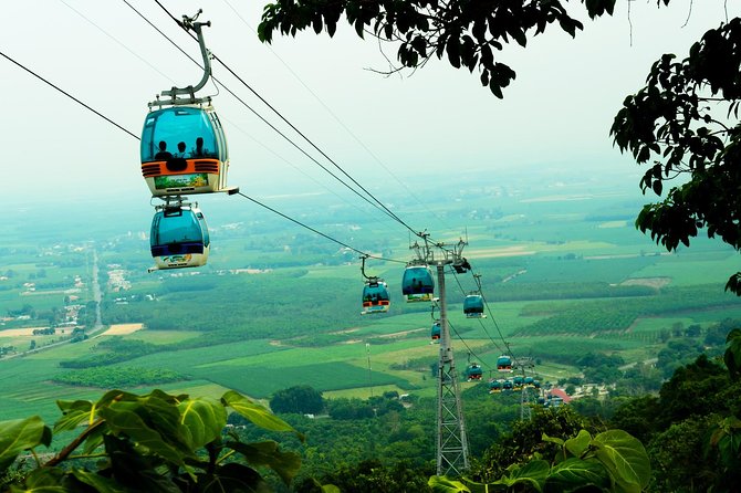
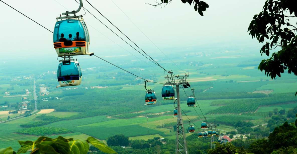
When you’re in Vietnam, hiking Ba Den Mountain (also called Ni Bà en, Black Virgin Mountain, or Old Lady Mountain) should be at the top of your list. It’s a popular day hike because it’s 986 meters high and the highest point in South Vietnam (3,235 feet).
Some parts of the trail are very steep, so take your time and often stop to rest as you climb. You must bring water on the path because it gets hot during the day. When you get to the top, relax at the Sun World Ba Den tourist site and look around. There is no extra cost to go to the theme park.
Check out the colorful plants and topiaries, and look for the famous black bronze lady statue. You can also take a picture with the triangle-shaped sign at the top of the peak to show off what you’ve done. You can also hike back down the same trail or take the cable car, but you’ll have to buy a ticket for both ways. Explore Black Virgin mountain on Google Maps
Black Virgin Moutain Tours
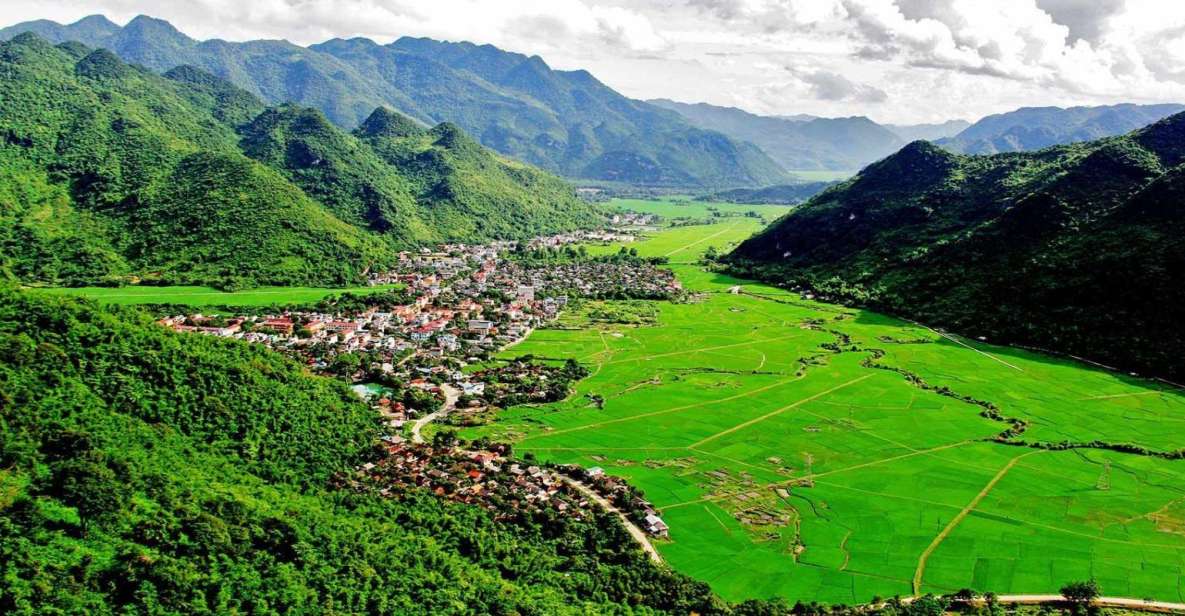
Mai Chau, Hoa Binh
- Vietnamese name: Mai Châu
- Location: Hoa Binh province, Northern Vietnam
- Distance: 5 to kilometers
- Duration: 3 to 4 hours
- Difficulty: Easy
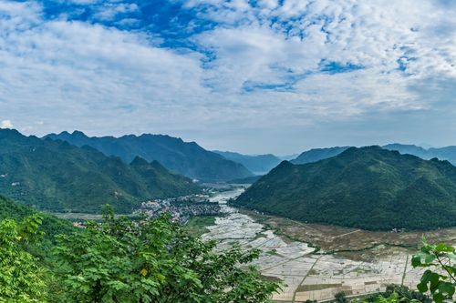
Mai Chau Valley, Hoa Binh
Mai Chau is an excellent place to go if you want an easy hike. If you have never been on a hike before, this is the one to go on. Mai Chau is about 150 kilometers from Hanoi. It’s almost like going to a whole new world. Here, you’ll find rural valleys with a calmer, more peaceful feel. You can also go to White Rock pass, Chieu Cave, Go Lao waterfall, Hoa Binh lake, and Thung Khe pass, among other places, while you are there.
Mai Chau is a mountainous area in Hoa Binh Province known for its fresh air, peace, and beautiful scenery. Mai Chau is known for ecotourism and is the home of people from different ethnic groups. Some of the best treks in Vietnam can be done in Mai Chau. Wandering around the rice fields and local villages (Cun Pheo, Ban Buoc, Hang Kia, and more) may become one of the best parts of your trip to Southeast Asia.
Try the 18km (11-mile) hike from Ban Lac village to Xa Linh village to get a taste of what the area offers. A local guide will help you get through the slippery trail, and you’ll need to set up a ride back to Mai Chau to meet you at the end of the track. Local homestays and lodges can set up longer treks, but it’s best to come during the week to avoid the weekend crowds. Explore Mai Chau on Google Maps
TourTeller’s Pick! – Mai Chau Tours
![[Hikking & Trekking] Tour to Mai Ha, Kha, Te, Buoc, Mai Hich Village (Full day)](https://media.tacdn.com/media/attractions-splice-spp-674x446/09/f7/7f/19.jpg)
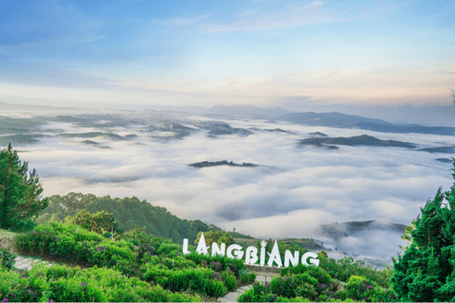
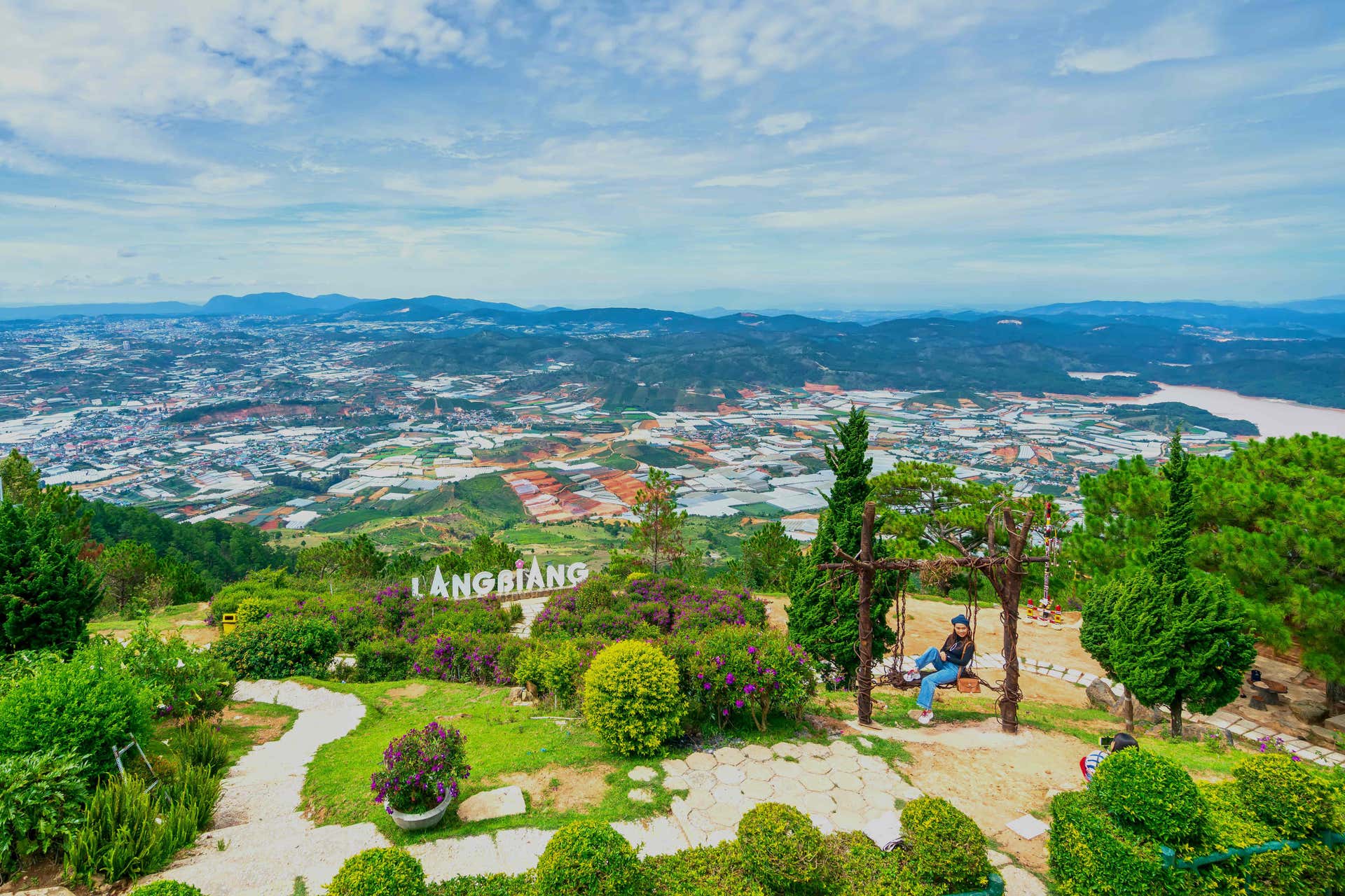
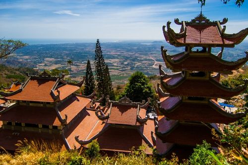
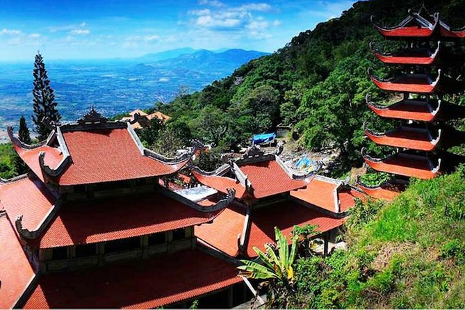
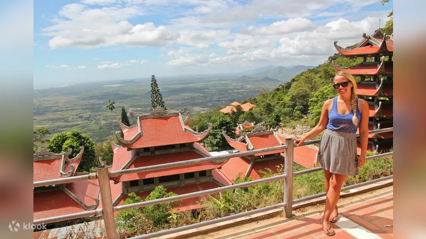
Lang Biang peak, Da Lat
- Vietnamese name: Đỉnh Lang Biang
- Location: Da Lat, Lam Dong province, Southern Vietnam
- Distance: 4 km of vertical climb
- Duration: 5-6 hours
- Difficulty: Difficult
Source: dalat.vn
Since Lang Biang is made up of the two highest peaks of Lam Vien Highland, Lang Biang (2,167m) and Bidoup Ban (2,287m), which is often called the “roof” of Dalat, it is the highest point in Lam Vien Highland. The mountain is well-known for its beautiful scenery and fantastic view of Dalat City, the forest, the rivers, and the homes of tribal people.
Lang Biang is an excellent place for tourists to go camping, explore nature, watch birds, and learn about the unique culture of ethnic minority groups. Lang Biang is also great for mountain climbing, conquering high peaks, paragliding, trekking, and other adventurous activities. “Thung lung Tram nam” (Hundred-Year Valley), at the mountain’s base, is a place for tourists to have fun and learn about the environment.
Located in Dalat, Lang Biang Mountain has three peaks, (1) a paved road leading up to a radar base, which most tourists use as it is an easy drive up with jeeps, (2) the actual Lang Biang peak at 2,167m, which can be reached by dirt roads/trails, and only hiking and (3) an unnamed peak. The trekking up to the top of Lang Biang Mountain, where the views are truly spectacular, takes 3 to 4 hours from Lat Village. The path begins due north of Lat and is easily recognizable as a red gash in the green mountainside. Take a walk with nature, burn off some calories, and snap some fantastic photos as you trek up to one of the most natural rooftops of Da Lat! Explore Lang Biang Peak on Google Maps
TourTeller’s Pick! – Mai Chau Tours

Bidoup – Nui Ba National Park
- Vietnamese name: Vườn quốc gia Bidoup Núi Bà
- Location: Lac Duong, Lam Dong province, Southern Vietnam
- Distance: 28 kilometers
- Duration: 1 to 2 days
- Difficulty: Intermediate
Bidoup Landscape
Bidoup Nui Ba National Park is remote and often overshadowed by the nearby Lang Biang Mountain, but don’t let that stop you from hiking there, my friend! You should check out Bidoup. The national park is quiet, and you will find few people. This is great because it allows you to walk through the forest without being bothered.
The only bad thing about getting to the top of this mountain is that, since it is in the middle of a forest, it has a different expansive view than other mountains on this list. You can walk through the woods without being bothered and reach the peak, which is 2,287 meters high (7,503 feet). Then you can still take a picture with the triangle-shaped summit sign to show that you’ve reached the top! This is a more challenging hike for people who have hiked before. Joining a tour group for two days and one night at a campsite is better. Explore Nui Ba National Park on Google Maps
Day Tour Trekking to Nui Dinh from Ho Chi Minh City
Ta Cu Mountain, Binh Thuan
- Vietnamese name: Núi Tà Cú
- Location: Binh Thuan province, Southern Vietnam
- Distance: 7.2 kilometers
- Duration: 2 to 3 hours
- Difficulty: Easy
From the Ta Cu Mountain Temple
If you want to see the most extensive Buddha lying down in Southeast Asia, you should go to Ta Cu Mountain. The mountain is part of a more significant tourist attraction called TTC World Ta Cu, which has a beautiful garden and rides for kids. The best thing about hiking up Ta Cu mountain is that it’s quiet because no one else is on the trail.
You can stroll through the forest and enjoy the peace. But you will see some unexpected things along the way. On this trail, you might see a monkey every once in a while. Since monkeys are known for stealing something, you should put away anything that can be grabbed or stolen.
When you reach the mountain’s peak, you’ll climb a set of stairs to reach the Buddha statue lying down. The height of 476 meters (1,564 feet), while the top of the mountain is 649 meters (2,129 feet). Explore Tà Cú mountain on Google Maps
Compare Ta Cu Mountain Tours

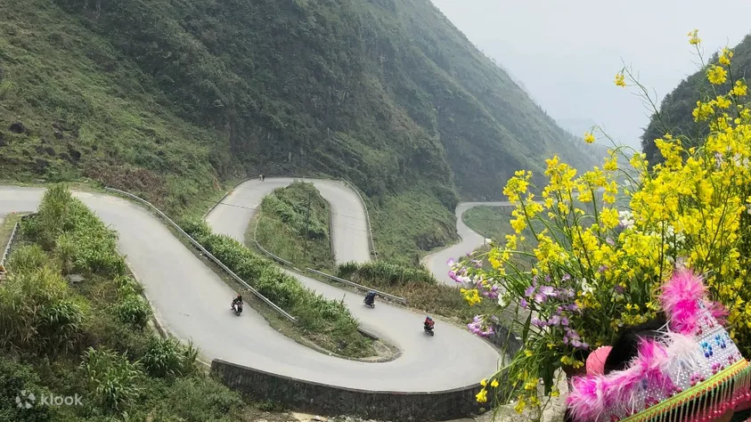
Ma Pi Leng Pass, Ha Giang
- Vietnamese name: Đèo Mã Pí Lèng
- Location: Ha Giang province, Northern Vietnam
- Distance: 4 km to 38 km
- Duration: Most treks in Ha Giang range from 2-to-5 days
- Difficulty: Easy
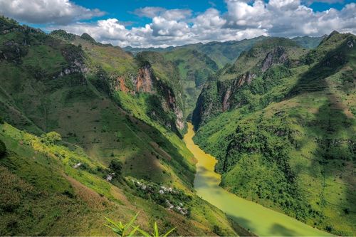
Ma Pi Leng Pass
Trekking level: Easy. Ha Giang is in the northernmost part of Vietnam, about 300 kilometers northwest of Hanoi, which borders China.
This province is one of the best places for adventure lovers because it is far away and mysterious. Ha Giang is famous for having beautiful mountain landscapes, rolling hills, impressive karsts and green valleys, roaring rivers, smiling people, and cute ethnic kids. Still, because it is so far from Hanoi, many travelers miss it.
Hiking & trekking routes in Ha Giang are far enough from the tourist trail that you can spend days alone in the mountains of Ha Giang. Aside from the beautiful scenery, it’s easy to get to the most authentic, ethnic side of Vietnam, which comprises unique tribe villages. Some of the best things about Ha Giang are Quan Ba Twin Mountain, Dong Van Town, Lung Cu Flagpole, Meo Vac Valley, Ma Pi Leng Pass, and Hoang Su Phi rice terraces.
Ha Giang’s trip is about climbing the highest peak of the eastern border city, which has a wide range of trails and valleys. Getting from Don Teng to Medak can be tricky if you have to cross a lot of intersections and climb a lot of other mountains. But the view is so great that it is one of the most well-liked destinations to go hiking & trekking in Vietnam. From the top of the Ma Pi Leng Pass, you can see valleys and the peaks of limestone mountains. Then go down into the deep, beautiful valleys where fields and rocky mountains decorate the landscape. Explore Ma Pi Leng pass on Google Maps
Best Ha Giang Tours

Pu Luong Nature Reserve, Thanh Hoa province
- Vietnamese name: Pù Luông
- Location: Thanh Hoa province, Central Vietnam
- Distance: An area of 17,662 ha
- Duration: 3 – 4 days
- Difficulty: Moderate to Challenging
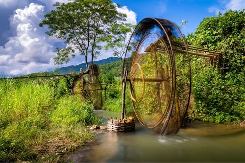
Pu Luong Waterwheel
Pu Luong Nature Reserve should be at the top of your list if you want to go hiking in a less crowded, more natural, and more beautiful place. Pu Luong is on the border of Hoa Binh’s and Thanh Hoa’s provinces, about 160 km southwest of Hanoi.
It’s a popular place for locals to go on the weekends, and more and more people are coming from other countries to see it. This hidden gem combines Northern Vietnam’s beauty with charming terrace rice fields like Sapa, beautiful passes like Ha Giang, and green fields like Mai Chau. It has a rich forest, limestone views, beautiful rice terraces, and breathtaking scenery. With a land area of 17,662 ha, Pu Luong has many plants and animals. You can also see how the Thai and Muong people live and learn about their culture. Explore Pu Luong on Google Maps
TourTeller’s Pick! – Pu Luong Tours


Bach Ma National Park, Hue province
- Vietnamese name: Vườn quốc gia Bạch Mã
- Location: Hue province, central Vietnam
- Distance: 7-kilometer trek in the five lakes
- Duration: 6 to 7 hours
- Difficulty: Easy – Medium
Source: adventurejourney.vn
Bach Ma National Park is in a mountainous area on the border between North and South Vietnam, about 45 kilometers southeast of Hue City. It runs from the border with Laos to the East Sea at the Hai Van Pass, heading west to east. You can see both landscapes here, making Bach Ma much more interesting than the other national parks.
This area is beautiful because it has blooming waterfalls, cool forests, and rhododendrons. Bach Ma is a big part of Hue tourism, but more foreign tourists than locals go there. Unsurprisingly, their adventurous nature is given as a reason. Most of the time, the adventure tour starts with a car ride to the peak, which is 1,450 m above sea level, followed by a 7-km hike through the five lakes. Even though the trek isn’t challenging, you need ropes to get over some 10-meter cliffs. This little adventure, which takes only 6 to 7 hours, is a break from the slow and calm way of traveling in central Vietnam. Explore Bach Ma National Park on Google Maps
TourTeller’s Pick! – Bach Ma National Park Tours

Ba Be National Park, Bac Kan province
- Vietnamese name: Vườn quốc gia Ba Bể
- Location: Bac Kan province, Northern Vietnam
- Distance: Distances vary
- Duration: from 1 day
- Difficulty: Moderate
Source: fareastvacation.com
Trekking level: Easy – Medium. Highlights: Ba Be National Park is a beautiful national reserve 240 km from Hanoi. It has rolling hills, tall limestone karsts, and more than 550 plant species.
Ba Be isn’t too affected by tourists, so it still feels natural. It has beautiful landscapes like thick rainforests, clear lakes, high limestone mountains, and caves in the middle of tall peaks. A lot of people from different ethnic groups live in the area as well. A multi-day trek tour through karst outcrops, waterfalls, caves, and rice fields is perfect for nature lovers with moderate to good fitness and a strong sense of adventure. Explore Ba Be National Park on Google Maps
Best Ba Be National Park Tours
Cat Ba Island, Hai Phong province
- Vietnamese name: Cát Bà
- Location: Hai Phong province, Northern Vietnam
- Distance: The challenging 9km trekking trail through the park to Viet Hai Village.
- Duration: up to 5 – 6 hours
- Difficulty: Easy
Cat Ba Island
The largest island in Halong Bay, which is included on the World Heritage Sites list, is called Cat Ba. Additionally, it is the only island that has a significant population living on it. In April 2005, UNESCO named Cat Ba a World Biosphere Reserve because of its unique beauty and ecological value. UNESCO says that the area has ecosystems such as humid tropical forests, wetlands, mangroves, and coral reefs.
This national park is also the residence of 32 types of mammals, including most of the 65 golden-headed langurs, the most endangered primate in the world. Cat Ba is an excellent place to go if you have extra time and want to explore the island, its national park, the beaches, and Lan Ha Bay. This island is big enough for a reasonably challenging trekking tour that can last up to 5–6 hours per day and make you sweat. Cat Ba Island is where Vietnam Travel offers trekking and other exciting activities like kayaking, rock climbing, and cycling.
Cat Ba National Park in Halong Bay has landscapes that are almost too green to be real. Moss beds and forest glades have shades of emerald, lime, chartreuse, and other greens. And the best way to see this colorful landscape is on foot, beginning at the park’s headquarters in Trung Trang. Guides are not required, but they will help you get closer to the animals. Keep a sharp lookout for golden-headed langurs, the world’s most critically endangered primate. Explore Cat Ba National Park on Google Maps
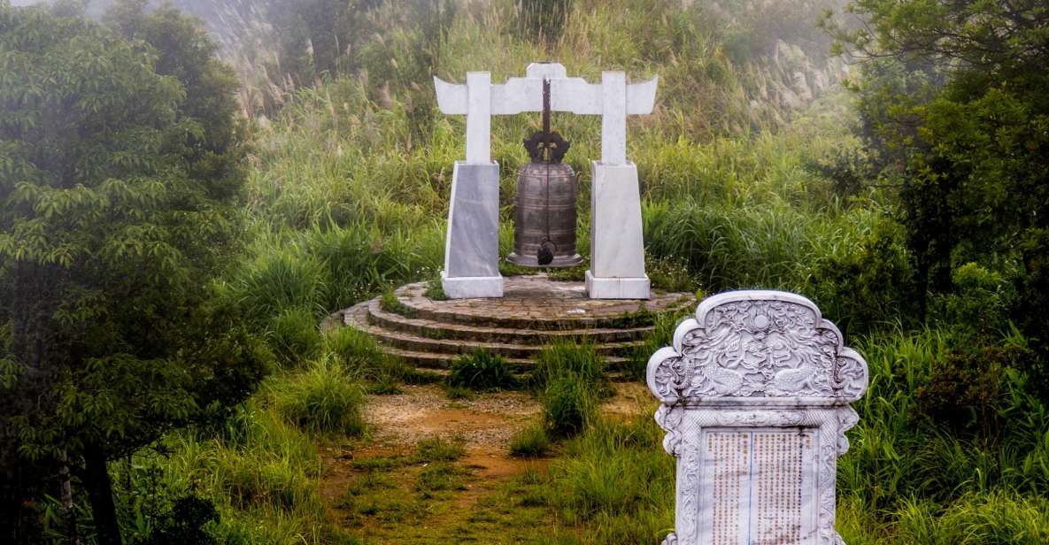
Yen Tu Mountain, Quang Ninh
- Vietnamse name: Yên Tử
- Location: Quang Ninh province, Northern Vietnam
- Distance: 14.8-km out-and-back trail
- Duration: an average of 6 h, 56 min
- Difficulty: Easy
Yen Tu Mountain and historical archetecture
Yen Tu is a famous Buddhist land with a Yen Tu tourist area with poetic beauty and a system of temples with unique ancient architecture, attracting tourists from all over the world.
It is also known as Tuong Dau mountain, is located between the border of Bac Giang and Quang Ninh provinces. This mountain belongs to the Dong Trieu mountain range in the Northeast of our country, with a height of 1068m above sea level. It is also home to a diverse range of flora and fauna. The Truc Lam Yen Tu Zen sect was responsible for establishing the Yen Tu tourism area, which serves as a repository for historical and cultural artifacts linked with the sect’s establishment and growth.
Along with the beautiful mountain scenery, cool climate, and untouched nature, this place has become a spiritual tourist destination attracting tourists from far and near. Quang Ninh has a typical weather pattern of the Northern region with four distinct seasons of the year.
Traveling to Yen Tu Quang Ninh is best in the spring, from January to March, of the lunar calendar. At this time, the weather is cool and pleasant. The mountain road is about 6km long with a travel time of about 6-8 hours for a time of a few people. Walking is a form of health training and a challenge to conquer Yen Tu that many people set for themselves. The road is tricky, but you will admire the wild beauty of the mountains and forests. Explore Yen Tu mountain on Google Maps
Best Yen Tu Mountain Tours

Chua Chan Mountain, Dong Nai
- Vietnamese name: Núi Chứa Chan
- Location: Dong Nai province, Southern Vietnam
- Distance: 7.5 kilometers
- Duration: 3-5 hours
- Difficulty: Moderate
Source: nld.com.vn
Driving time from Ho Chi Minh City to Chua Chan Mountain in Dong Nai Province is around two hours. Chua Chan Mountain is located in Dong Nai Province. Chua Chan mountain’s peak is only 800 meters high, but it is still hard to climb. The first half of the hike is mostly up paved stairs, which can be hard on the legs. After mounting them, you can take a break in the pagoda shade.
Here, you can eat sizzling pancakes called bánh xèo or fried banana chips. After the pagoda, you’ll take a dirt path to the top. You will see the famous banyan tree, fantastic caves, and beautiful scenery everywhere. The dirt path is easy to follow, and you can spend the night at the top if you want to.
Chua Chan Mountain (Ni Cha Chan) is a great place to spend a day hiking in South Vietnam. It is in Dong Nai Province, about two hours from Ho Chi Minh City. You must climb 837 meters (2,746 feet) to reach the top. The out-and-back trail is easy to follow, so you don’t need a tour guide. In the first half of the hike, you climb up a paved set of stairs, which is hard on your legs. This path is shaded so that you won’t get too hot in the middle of the morning. It is South Vietnam’s second-highest peak. Explore Chua Chan mountain on Google Maps
Bu Gia Map National Park, Binh Phuoc
- Vietnamese name: Bù Gia Mập
- Location: Bu Gia Map, Binh Phuoc Province, Southern Vietnam
- Distance: Various – Around 12 kilometers (7.5 miles) over two days
- Duration: Over two days with lots of breaks
- Difficulty: Easy to Moderate
Source: megatravel.vn
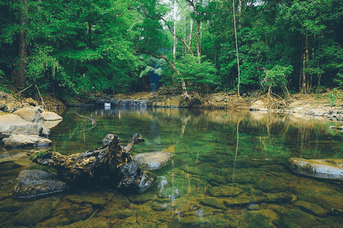
In South Vietnam, Bu Gia Map National Park is a small national park where people can hike through the forest and streams, camp, and relax by the waterfalls. Many people stay for at least two days and one night.
This national park is excellent for people who have never been hiking because the trail is easy. So, even very young kids can join in on this adventure.
On the first day, hikers walk through the forest and see beautiful leaves and exciting tree branches. There are some steep downhills, but it’s alright as long as hikers go slowly. Everyone walks to the campsite, where tents are set up, and food is made.
On the second day, the hike is flat, and to get to the lunch spot, you must walk through ankle-high streams. It feels good to walk through the streams. You only need to be careful of the rocks and boulders in the water. Explore Bu Gia Map on Google Maps
What to Bring On Your Vietnam Hikes
Before heading out on a hiking trail in Vietnam, you must get ready. Here are some excellent hiking tips and essential items you’ll need.
Put your essential things in a backpack. When you’ve been hiking for hours, shoulder and hip belts will help you move the weight of your pack around. Here is our recommended backpack for both men and women, suitable for hiking & trekking in Vietnam’s weather.
Stay hydrated, and bring a water bottle you can use again. There are only a few convenience stores near many trails, so you can’t buy water there. Continue to drink a lot of water on the track and use a reusable water bottle to cut down on plastic waste.
Wear the proper boots or shoes for hiking. Some of the trails need hiking boots because the ground changes. With the right shoes, you can walk for hours without getting tired. Getting hot spots or blisters wouldn’t be fun. If you don’t like to wear heavy boots, these minimalist hiking shoes are an excellent choice for more accessible trails.
Put on a hat and sunblock. The sun can get scorching, so wearing a hat and sunscreen is essential.
You don’t have to use hiking poles. Hiking poles can help if your knees hurt or you’re climbing a steep mountain.
Bring your trash home, and don’t leave any signs. Let’s keep Vietnam’s mountains clean for people who come after you. Take all of your trash with you.
Best Time For Hiking In Vietnam
Before going on a trekking trip, it should go without saying that you should check the weather and be ready for anything. At the same time of year, the weather in different parts of Vietnam is very different.
Because of this, it’s essential to plan your trip so that it falls during the best trekking season for the place you want to go.
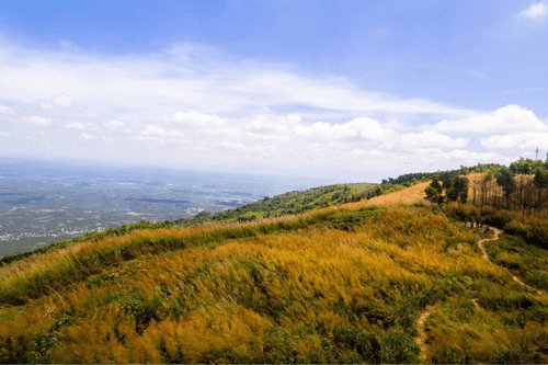
Northern Vietnam
The last week of September through the first week of October is the best time to trekking in Northern Vietnam. The weather is often pleasant during this time. Following the wet season, the environment is stunning, and the climate is perfect for activities that take place outside. It is crucial to keep in mind at all times that there is a possibility that the temperatures will become lower as the year advances.
South Vietnam
In contrast to the north, the weather in the south of Vietnam is nice and warm all year long. But it would be best if you stayed away from the middle of summer (April to August) and the rainy season (randomly from May to October). When the weather is more relaxed, and it doesn’t rain as much, the shoulder seasons are the best time to trek in South Vietnam.
Central Vietnam
Central Vietnam has a lot of big storms and typhoons during its rainy season. Travelers should avoid Central Vietnam between August and November to avoid these challenging trekking conditions. November through February can be a little cool and wet, but the weather changes in March. You have a few months of excellent hiking weather before June and August get too hot.
Conclusion
We don’t think anyone will disagree that Vietnam is a happy place. The countryside is a unique place for tourists to visit. You can hike through high valleys, terraces, and tall limestone mountains. Vietnam has a trail for everyone, no matter how much walking experience you have or how fit you are.
North Vietnam is the best place to see beautiful mountain views. There are nature reserves, national parks, and coastal areas in the rest of the country. Vietnam is a unique place to go hiking, and you should try it. Here, you can hike through high valleys, terraces, and limestone mountains; there’s a lot to see.
Best Tours & Activities in Vietnam